Sunday, October 02, 2011
The Texas drought in comparative pictures
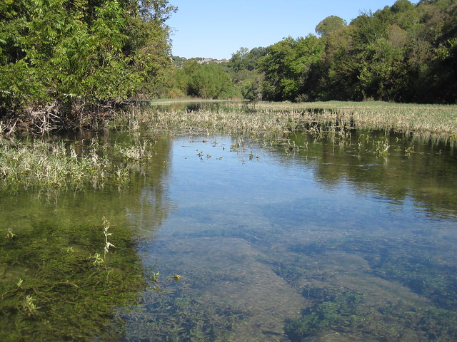
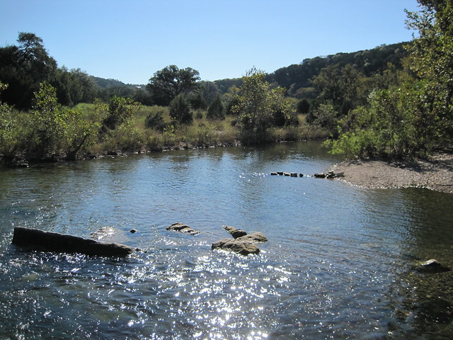
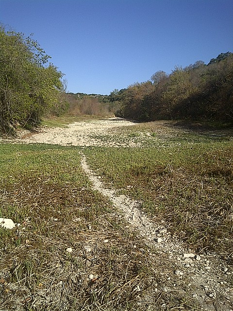
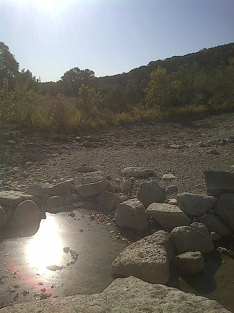
By accident, I ended up with virtually identical pictures of Barton Creek, which -- in theory -- flows through Austin, one set taken almost exactly on the anniversary of the first.
Here is Barton Creek, from a spot on the Greenbelt, in October 2010:
Here are the same views, respectively, in October 2011:
Central Texas need a helluva lot of rain just to get back to normal.
11 Comments:
By , at Sun Oct 02, 02:42:00 PM:
http://droughtmonitor.unl.edu/
By , at Sun Oct 02, 04:36:00 PM:
Ouch, that is going to leave a mark. My son and his girlfriend just got back from a visit to Austin. They loved the flight of the bats at sunset.
By joated, at Sun Oct 02, 08:24:00 PM:
Too bad we can't send some of this excess rain the northeast down that way.
By TOF, at Sun Oct 02, 11:19:00 PM:
What's normal? With that wide a variation in hydrological conditions normal could be a lot less than what you saw in 2010. Does anyone know what normal is?
By sykes.1, at Mon Oct 03, 08:18:00 AM:
It was like this in the 1930s, too. So, "normal" is somewhere between the wet picture and the dry picture, 1 vs. 3.
The American Southwest is in the desert zone of the world, i.e., 30N and 30S and 90N and 90S. The wet zones are the tropical and the temperate rain forests, 0 and 60N and 60S. These zones are generated by the large scale atmospheric circulation imposed by differential heating at the surface and the earth's rotation. Local variations occur at decadal frequencies.
By Willuz, at Mon Oct 03, 11:48:00 AM:
Most of west Texas is desert so dry conditions are expected. At 5bil lost in one year though, maybe it's time to engineer a solution. We seem able to pipe oil all over the country, so why not do it with water? Build one or several very large underground pipes from the Mississippi river in Louisiana for farms in TX. As a bonus, the water is already heavily fertilized so it's good for crops and saves the gulf from an overdose of nitrates.
It seemed to work for the Romans, maybe it's time to try it again.
By Dawnfire82, at Mon Oct 03, 04:49:00 PM:
Desalination? Though I thinks that's energy intensive...
By darovas, at Tue Oct 04, 04:21:00 PM:
@Willuz, this is a problem I have given to freshman physics students. The elevation of west Texas ranges from 2000 to 5000 feet mostly. Compute the power required to transport one acre-foot of water from sea level to 3000 feet over one year. Answer: about 350 watts. The annual flow of the Mississippi is about 430 million acre-ft. The Colorado is much smaller - about 15 million acre-ft/yr, of which California gets about 5 million. I've read projections saying water demand in Texas will rise to about 22 million acre-ft by 2060 (state-wide). Suppose we wanted to pump 5 million acre feet from Louisiana out to west Texas. Assuming a 3000 foot elevation, this would require about 1750 MW of power. For some context, the San Onofre Nuclear Generating Station up the road from me generates about 2200 MW. Of course the above estimate doesn't account for frictional losses or energy associated with construction, but it does suggest this should be possible, with a couple of modest nuclear generating stations along the way.
By , at Tue Oct 04, 06:04:00 PM:
The things that cheap energy can enable!
By , at Thu Oct 06, 07:49:00 PM:
Have to agree with TOF - there's average, but it's not clear there's normal. Here in Atlanta, at average rates of rainfall it was going to take 15 years to refill Lake Lanier after the last drought. It was full again about six months after the drought broke.
By knighterrant, at Sat Oct 08, 12:41:00 PM:
The "Texas Drought" is a hoax being spread by the Global Warming fanatics. Liberals are spreading these lies to advance there socialist agenda.
There is absolutely no reason for humans to have to "do something" about the weather. Big government ideas like water building pipelines or de-salting the ocean are the kind of things that socialist California does.


